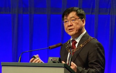
Big Data in Photogrammetry and Remote Sensing
Jul 16, 2016
About
With the rapid construction of smart earth and smart city applications, the era of big data has arrived. In this talk the author will answer the key questions related to big data in photogrammetry, remote sensing, and geospatial information: how big are big data, how to treat these big data, and how to discover the patterns, rules and knowledge that can be obtained from big geospatial data. Three application examples are used to illustrate the value of big data in photogrammetry and remote sensing. The first example is in huge block adjustment without GCP for all of China. Using ZY-3 three-line CCD Data (8810 frame, 20TB), 3,000,000 robust tie points are automatically selected from two billion matched points for adjustment. The accuracy reaches 3-5m,meeting global mapping needs at the 1:50,000 scale, while accurate three meter results can be reached when combined with GRASS data in block adjustment. The second example is night light remote sensing data analysis for socio-economic applications. The visible and near-infrared brightness of the earth surface obtained by remote sensing satellites (such as DMSP, NPP) can be used to characterize the range of urban settlements, GDP, population distributions, and other socio-economic factors. Economic growth, urbanization, humanitarian disasters are likely to be reflected in changes of brightness in remote sensing images over a period of time. A four years image series shows that the Syrian civil war has led to a significant reduction (more than 80%) in the night light levels in Syria. On March 26, 2015; the United Nations Security Council released a briefing citing this Syrian night time light research. A third example is automatic Video satellite data compression. Our solution can send video satellite data direct to end-user’s Smartphone.With the rapid construction of smart earth and smart city applications, the era of big data has arrived. In this talk the author will answer the key questions related to big data in photogrammetry, remote sensing, and geospatial information: how big are big data, how to treat these big data, and how to discover the patterns, rules and knowledge that can be obtained from big geospatial data. Three application examples are used to illustrate the value of big data in photogrammetry and remote sensi…
Organizer
ISPRS 2016 Congress - Prague
Account · 26 followers
Categories
AI & Data Science
Category · 10.8k presentations
About ISPRS 2016 Congress - Prague
We proudly announce that Prague is the hosting city of the XXIIIrd Congress of International Society for Photogrammetry and Remote Sensing. The General Assembly at the XXIInd ISPRS Congress in Melbourne elected Prague as the next host of the Congress. Lena Halounová, the chairperson of the Czech Society for Photogrammetry and Remote Sensing (SFDP - http://www.sfdp.cz/), was appointed the Congress Director. Organizers of the Congress are eager to provide excellent services for all participants in order to prepare a fully convenient and pleasant event. Prague and its citizens will be more than happy to make you feel satisfied and comfortably during the Congress.
Like the format? Trust SlidesLive to capture your next event!
Professional recording and live streaming, delivered globally.
Sharing
Recommended Videos
Presentations on similar topic, category or speaker
3D Reconstruction from Photographs
Watch later
Total of 0 viewers voted for saving the presentation to eternal vault which is 0.0%
Data from Remote Sensing for Development and Applications
Watch later
Total of 0 viewers voted for saving the presentation to eternal vault which is 0.0%
Planetary Scale Data Processing and Management with Google Earth Engine
Watch later
Total of 0 viewers voted for saving the presentation to eternal vault which is 0.0%
Societal Benefits and GEO's Second Decade
Watch later
Total of 0 viewers voted for saving the presentation to eternal vault which is 0.0%
Knowledge Discovery for Global Sustainability
Watch later
Total of 0 viewers voted for saving the presentation to eternal vault which is 0.0%
ISPRS Opening ceremony - Jun Chen
Watch later
Total of 0 viewers voted for saving the presentation to eternal vault which is 0.0%


